- Printed on Tyvek® (synthetic)
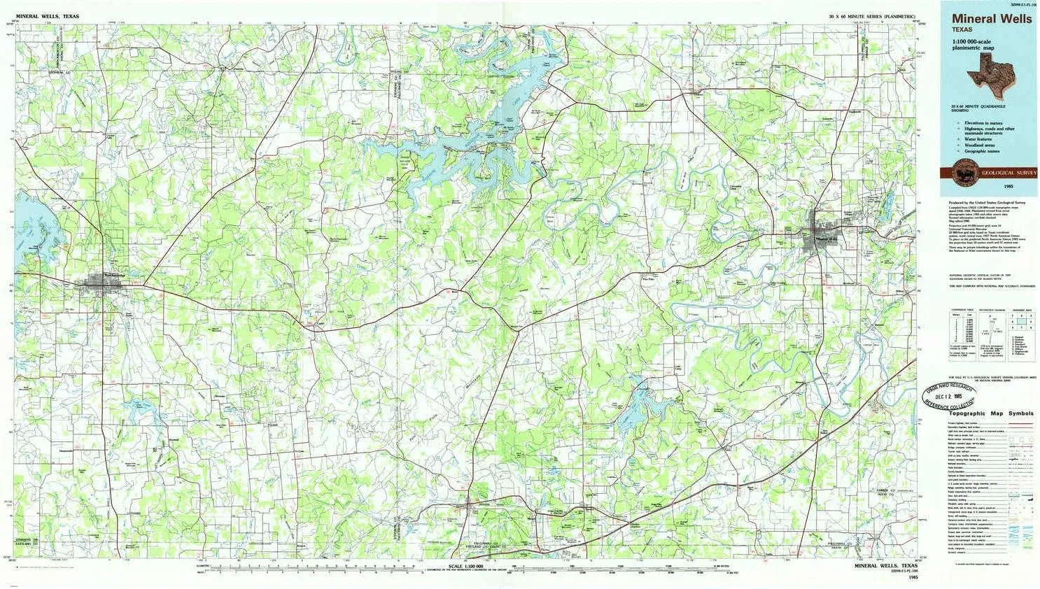
- USGS topographic map of Mineral Wells, TX, at 1:100000 scale. Lighter material. Waterproof. Tear-resistant. Foldable. Very durable. Perfect for backpacking and the outdoors.
- Mountains: Palo Pinto Mountains,Donkey Mountain,Clayton Mountain,Warters Mountain,Dickson-Walker Mountain,Double mountain,Russel Mountain,Maxwell Mountain,Potato Hill,Bee Branch Mountain,C J Mountain,Evensville Peak
- Valleys: Live Oak Canyon,Bear Canyon,Hamilton Hollow,Wilson Hollow,Rocky Hollow,Long Hollow,Sam Bass Hollow,Shot Hollow,Pecan Hollow,Texawa Canyon,Devils Hollow,Thunderburg Hollow,Kettle Hollow,Brewton Canyon
USGS topographic map of Mineral Wells, Texas, dated 1985, updated 1985.
Includes geographic coordinates (latitude and longitude), lines of elevation, bodies of water, roads, and more. This topo quad is suitable for recreational, outdoor uses, office applications, or wall map framing.
Printed on-demand by YellowMaps on the print material of your choice.
Shipping rolled from Minneapolis, MN, United States.
Product Number: USGS-5479993
Map Size: 24.1 inches high x 42.9 inches wide
Map Scale: 1:100000
Map Type: POD USGS Topographic Map
Map Series: HTMC
Map Version: Historical
Cell ID: 67962
Scan ID: 118193
Imprint Year: 1985
Woodland Tint: Yes
Visual Version Number: 1
Aerial Photo Year: 1983
Edit Year: 1985
Datum: NAD27
Map Projection: Universal Transverse Mercator
Planimetric: Yes
Map published by United States Geological Survey
Map Language: English
Scanner Resolution: 600 dpi
Map Cell Name: Mineral Wells
Grid size: 30 X 60 Minute
Date on map: 1985
Geographical region: Texas, United States
Northern map edge Latitude: 33°
Southern map edge Latitude: 32.5°
Western map edge Longitude: -99°
Eastern map edge Longitude: -98°
Surrounding map sheets (copy & paste the Product No. in the search bar):
North: USGS-5479879,USGS-5490885,USGS-5479881,USGS-5490887
East: USGS-5480855,USGS-5478337,USGS-5480853,USGS-5480857,USGS-5478335
South: USGS-5483979,USGS-5480149,USGS-5480429,USGS-5480431,USGS-5480435
West: USGS-5480145,USGS-5480233,USGS-5480235,USGS-5487953,USGS-5480237


")

